|
Monday
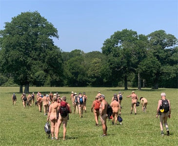
19th January - Naturist Ramblers AGM - Robertsbridge
The
Club's AGM and annual nude dinner for NatRam / Stark Trekkers
members only.
See photos of the AGM
|
 |
Tuesday
24th February - Chilegg - near Canterbury - 7 Miles
This
walk follows a similar route to the start of the Egg & Denger
walk, but with a shorter return route in which we explore some
remote corners of the ancient Eggringe Wood with its disused
flint mines, venerable trees, mysterious deep holes and a beautifully
managed nature reserve. Lunch will be in our regular sheltered
perch with rolling views down the Stour Valley. Even this early
in the year, there may be signs of Spring returning such as celandines,
primroses and violets already in flower.
See photos of the 2024 walk
|
 |
Tuesday
31st March - Heathfield - Heathfield - 6.5 Miles
This
is a circular walk over farmland and through woods with short
sections of moderate climbing. The walk enjoys classic High Weald
scenery - an enchanting mix of woodland and rolling pastures.
We begin and end on the route of a former railway and cross a
landing-strip for light aircraft. We may encounter sheep and
cattle en route.
See photos of last year's walk
|
 |
Wednesday
22nd April - Devil's Hike (New) - near Brighton - 6 Miles
This
is a walk based around Devil's Dyke, a 100m deep dry valley supposedly
dug by the Devil as part of a bet with a hermit called Cuthbert
of Steyning. We head north following the foot of the Downs following
the local stream, through fields where we lunch in a sheltered
spot. After lunch we follow a winding bostal up to the South
Downs Way, then eastwards along the ridge towards the Devil's
Dyke. Crossing the road we descend into the dyke to walk the
entire valley floor, then north back to our starting point.
|
 |
Thursday 30th April
- NatRam - Pilgrim's Way - near Canterbury - 12 Miles (S)
The
walk starts in a woodland car park just outside Challock. The
walk passes through a delightful mixture of open countryside
and woodland. In late April the woods should be carpeted with
bluebells. It follows a section of the Pilgrim's Way with great
views of Canterbury Cathedral, the Wye Downs and across to Romney
Marsh. Returning to the car park, for those who want it, supper
is at a nearby pub.
See photos of last year's walk
|
 |
Wednesday 6th May
- NatRam - Mayfield - Mayfield - 11 Miles (S)
This walk follows
a delightful wiggling route through a mixture of pasture and
woodland combining great views across the Weald with some enchanting
almost Alpine settings. We usually stop for lunch in Wadhurst
Park where herds of deer have often been seen grazing. In early
May the wooded sections and the fields and meadows of the return
section should be full of colourful wildflowers such as bluebells,
wood anemones and primroses among others, some of which are rare.
See photos of last year's walk
|
 |
Tuesday
12th May - NatRam - Dean's Bottom - near Goring on Thames - 12
Miles (S)
This
is a popular walk in our programme, and it is the sixth walk
in our collection to make use - briefly this time - of The Ridgeway
long distance path. We meet in a pretty Berkshire village and
walk through superb downland scenery in a large figure of eight.
Lunch is in a secluded valley with a rare stand of wild junipers.
There is a short walk option of 8 miles.
See photos of last year's walk
|
 |
Saturday
16th May - Stark Trekkers - Brede Valley - near Rye / Hastings
- 8 Miles
The
first few miles follow the 1066 Country Walk: a mixture of quiet
tracks and grassy hillsides. Spot some quirky chainsaw sculptures.
We then descend into the wide valley of the River Brede, crossing
a "Troll Bridge" to follow the banks of the river through
open scenery back towards our start point. The last part of the
return walk offers a choice of climbs! Both are very close to
the starting point. No dogs please, as we pass sheep, cattle
and horses along the route.
See photos of last year's walk
|
 |
Tuesday
19th May - NatRam - Wotton Wander - near Dorking - 12 Miles (S)
It starts at the same
place as the Leith Hill walk. Instead of going south, we go north
to the Downs which are open with south facing slopes for a good
part of the way. We rise gently eastwards to our lunch stop with
its fine views south across the peaceful valley around Wotton
Hatch, before following the general line of the North Downs Way
west for several miles along the forested tops of the North Downs
ridge to our tea stop. Here the Tillingbourne Valley spreads
like a map beneath our feet, then rises to the forests of the
Greensand Ridge of Holmbury Hill. We return east along the Way
with its crumbling collection of WW ll pillboxes, and along here
it is possible at one point to catch a glimpse of Chanctonbury
Ring on the far-distant South Downs. There are two short walk
options, one about 5 miles and the other about 6 miles.
See photos of last year's walk
|
 |
Thursday
28th May - NatRam - Tenbridge P'evels - near Pevensey - 10 Miles
(S)
This
walk starts from Pevensey and is soon in the marshy, remote-feeling
landscape of the Pevensey Levels, in one part of which we cross
no fewer than ten wooden bridges in a little over a mile before
returning over riverside fields. The end of the North Downs above
Polegate can be seen in the distance, with glimpses of the former
Hertsmonceux observatory in the other direction. We pass the
intriguingly named Horse Eye as well as some open water, which
at times has large numbers of waterfowl. There are two short
walk options, one about 5 miles and the other about 8 miles.
See photos of last year's walk
|
 |
Tuesday
2nd June - NatRam - Box Hill Maze - near Dorking - 11 Miles (S)
This
is a popular walk, being close to London and the M25. It starts
where the River Mole cuts through the North Downs and follows
an amazing tangle of footpaths through beautiful wooded and also
open territory with splendid views. You will need to be able
to cope with some steep climbs. It includes open downland
and thick yew woods, and a fine old quarry of almost Alpine beauty
forms our usual teastop, From there, there are two options to
return, one shorter and flatter than the other' mountain goat'
route which is more scenic.
See photos of last year's walk
|
 |
Tuesday
9th June - NatRam / BN - New Forest - near Ringwood - 12 Miles
This
walk is being run in conjunction with BN and members of both
organisations are welcome to participate. This year we repeat
our usual route heading north up onto the New Forest. The walk
typifies the Forest with vast expanses of heather and heathland
along with magnificent views. Not to mention ponies, ponds, and
extensive WWll history! The walk takes us through the Ashley
Walk bombing range where the Tallboy and Grand Slam bombs were
originally tested. Some of the targets still exist along with
a 10,000lb Tallboy bomb crater.
See photos of last year's walk
|
 |
Thursday
11th June - NatRam / BN - Dunbridge - near Romsey - 11 Miles
This
walk is being run in conjunction with BN and members of both
organisations are welcome to participate. The route follows public
footpaths and bridleways through varied scenery including woodland
and open farmland the walk cover parts of the National Trust
Mottisfont Estate and the Lockerley Hall Estate in the Dun Valley,
it includes a few gentle ascents and some stiles. Well-behaved
dogs are welcome on the walk although we will be passing through
fields where cattle will be grazing at which point dogs will
need to be on leads. There is a short walk option of about 7
miles.
See photos of the walk
|
 |
Tuesday
16th June - Stark Trekkers - Long Man Botanical - near Polegate
This
day is not actually a Stark Trekkers walk as such but a botanical
ramble within a limited area of the South Downs for those interested
in finding out about and learning to identify the specialised
flora of chalk grassland. We shall stop frequently to study and
photograph these superb wild flowers. Climbing up to the Long
Man of Wilmington we shall proceed westwards during the morning,
returning eastwards after lunch to look at the orchid bank situated
in the Folkington area which has delighted us for many years
on the full Stark Trekkers walk.
|
 |
Wednesday
17th June - NatRam - Empty Essex - near Maldon - 11 Miles (S)
This
is a stunning walk and takes Nat Ram into remote Essex. It is
a fascinating ramble starting from an old pub on the Blackwater
Estuary. Ignoring the de-commissioned nuclear power station,
the route follows the remote coastal path. Lunch is planned at
a naturist beach for those who want a swim. Following the coast,
then onto The Chapel of St Peter-on-the-Wall, which is among
the oldest Christian churches in England. The route then turns
inland through farmland back to our start point.
See photos of last year's walk
|
 |
Friday
19th June - Stark Trekkers - Long Man Downs - near Polegate -
5½ Miles
Celebrate
World Naked Hiking Day on this splendid downland walk which first
takes us to the well-known chalk figure of The Long Man and up
on to the Downs. We then start to descend towards the village
of Jevington, stopping for lunch at the Gallops. A lane takes
us back towards Folkington on our way to a lovely wild flower
bank with Bee Orchids amongst the diverse and distinct chalk
grassland flora. We then continue through woods before re-emerging
on to downland to take us back past the Long Man.
See photos of last Year's walk
|
 |
Tuesday 23rd June
- NatRam - Harting Down - near Petersfield - 11 Miles (S)
Downland walks are
always popular, and this circuit starts at the southernmost point.
We head north-east gradually ascending the dip slope to the crest
of the South Downs where we enjoy splendid views over the countryside
around the village of South Harting. After heading west along
the ridge, we close the loop through rolling fields and woods.
See photos of last year's walk
|
 |
Thursday
25th June - NatRam - Charlbury near Oxford - 10 Miles (S)
This is an attractive
circuit through the rolling Cotswold Hills with woods and hedgerows
and open fields allows us to walk nude for almost the entire
route. Our route after lunch takes us through the impressive
grounds of Ditchley Park, whose fine Palladian mansion we approach
for half a mile. It was built in 1720-2, and was used by Churchill
during WWII when bright moonlight made Chequers too easy to see
by the Luftwaffe. This former stately home is now an international
conference centre. The name comes from the Old English for 'Woodland
clearing' [-ley] on Grim's Ditch, built by the Romans. There
is a short walk option of about 8 miles.
See photos of last year's walk
|
 |
Wednesday 1st July
- Arun Gap - near Arundel - 10 Miles (S)
Our route heads west
to explore the northern end of the Arun Gap, and then the downland
ridge on the far side. A good half of the way is flat with much
of it along the banks of the peaceful tidal Arun through both
open meadows with wide views to the Downs to either side, and
woodlands. After a stop for lunch and a swim if desired, we continue
upriver before diverting off the riverside path through an old
quarry up on to the ridge to the west. This has superb views
over the Arun Gap; north over the Weald as far as Leith Hill;
and south to Arundel Castle and Cathedral then out to the sea.
Part of the route takes us into Arundel Park where unfortunately
dogs are not allowed.
See photos of last year's walk
|
 |
Tuesday
7th July - Stark Trekkers - Brightling - near Battle - 7 Miles
There
is much varied countryside on this route which has a distinctly
remote feel in places considering it is in the crowded south-east!
The walk follows tracks through ancient woodland as well as tracts
of open meadowland. At one point (on a clear day) both the North
and South Downs can be seen - in opposite directions of course!
Spot the gypsum mine and 18th century follies en route! A highlight
of this route is a stand of truly magnificent ancient Beech trees,
now sadly in decline.
See photos of last year's walk
|
 |
Thursday 9th July
- NatRam - Winklebury (New)
- near Salisbury - 11 Miles
This new walk starts
from delightful pub on Cranborne Chase. The walk leaves the village
heading first west, then southwards up onto the high chalk downland
(steepish ascent) before dropping to the lunch stop in a glorious
deep coombe on the other side. Then into Chase Woods for some
distance before emerging back onto the chalk hills and the magnificent
views from Winklebury Hill Fort enjoyed during the tea break.
The return route follows tracks and crosses open pastureland
between minor hamlets. Dogs will need to be on leads where livestock
are present.
|
 |
Thursday
16th July - NatRam - Bury Down - near Didcot - 12 Miles
This
is a wonderful walk over the rolling chalk downs between Reading
and Didcot. From the village, we will climb up onto and then
walk westwards along the ancient Ridgeway - used since man first
came to Britain - with its great views to the north and south.
After lunch we will continue for a while before turning south
to drop down into a picturesque and winding valley for our tea
stop, before continuing down it to make a wide circle back to
our start point.
See photos of last year's walk
|
 |
Friday
17th July - Stark Trekkers - Hoo Bike Ride - near Gravesend -
15 Miles
This
is a cycle ride only, the annual Stark Trekkers ride. We cycle
out on a gravelly, sandy and grassy tracks, past the RSPB Cliffe
Pools Reserve and a strange inlet with a salt marsh island to
the Thames sea wall, which we follow east as far as Egypt Bay
where we stop for lunch, sunbathe, and perhaps a swim at high
tide off its shelly beach, before returning by the same route.
The only short option available is to turn back early. It is
recommended that you bring a pump and puncture repair kit and
spare inner tube, as the tracks in places have sharp stones.
See photos of last year's cycle
ride
|
. |
Tuesday
21st July - NatRam - King's Castle - near Lewes - 12 Miles (S)
This
is a superb ramble over the South Downs near Lewes. The start
point is a very fine village pub. From here we follow the South
Downs Way up a paved lane up to a ridge and follow it until in
a couple of miles the highest point of our walk stretches as
a most strideable sward of closely cropped turf with splendid
views in all directions over the Ouse Gap. After a while, we
leave the Way and dip into a splendid coombe which we follow
seawards, until our way climbs out of it, and we return to the
village with its welcome and welcoming pub.
See photos of last year's walk
|
 |
Thursday
23rd July - NatRam - Grovely Woods - near Salisbury - 11 Miles
(S)
This
is a beautiful walk on the chalk downland near Salisbury. It
follows a mixture of Roman Roads and old ox drove tracks, with
distant views of Salisbury Cathedral and its spire!
There is a short walk option of 8.5 miles
See photos of last year's walk
|
 |
Thursday
30th July - NatRam - Friston Forest - near Eastbourne - 11 Miles
(S)
This
is a beautiful walk, the basis of which featured in our first
1993 programme and is still a favourite, with forest, open downs
and precipitous chalk cliffs. We take a route heading north along
the east bank of the river, where a quick swim might be in order,
before leaving it to climb up through a winding valley and emerge
on the top of the downs. We finish up by striding across closely
cropped turf along the top of the famous Seven Sisters chalk
cliffs to Birling Gap. There may be time for a swim stop before
walking back to the pub for dinner. There is a shorter option
of 8 miles.
See photos of last year's walk
|
 |
Wednesday
5th August - NatRam - Wepham Down - near Arundel - 11 Miles (S)
The
route follows a newish shorter [and less muddy!] version of our
old walk across the stunning South Downs. It explores the high
rolling chalk downland north of Arundel. It is very open and
nude friendly with magnificent views. Much of the walk follows
the South Downs Way with spectacular views both north across
Amberley Wild Brooks and the Weald, and south to the sea. There
is a short walk option available of about 6 miles.
See photos of last year's walk
|
 |
Thursday
6th August - Stark Trekkers - North Downs One Way - near Lenham
- 6 Miles
This
is a gentle stroll along the North Downs Way in mid Kent. We
follow the undulating trail westwards for several miles with
views to the south across the Stour Valley. Lunch involves a
bit of a climb up the face of the North Downs, rewarded by wider
views to the south. Most of the route is sheltered by the hills
and intermittent hedgerows.
See photos of last year's walk
|
 |
Wednesday
12th August - NatRam - Sugar Hill - near Hungerford - 11 Miles
This
is a magnificent walk on the high chalk downland between Hungerford
and Swindon. The walk follows the ridge up to the impressive
Liddington Castle which was one of the earliest Iron Age hill
forts in Britain, with first occupation dating to the seventh
century BC! We then follow a fine route along a west facing escarpment
partly parallel to, and then on, the Ridgeway before heading
east back to the village.
See photos of last Year's walk
|
 |
Saturday
15th August - NatRam - Hoo Peninsula - near Gravesend - 11 Miles
(S)
This
mostly flat walk is in a most unusual setting exploring a huge
and virtually deserted area of marshland on the Thames Estuary,
which is why we can do it on a Saturday. This area is full of
historical interest, it being the setting for Charles Dickens
'Great Expectations'. In addition there is much evidence of WWll,
not to mention its chequered smuggling history! The date of the
walk is set so that the state of the tide should give us the
opportunity for a swim in the Thames at lunchtime. Near the end
are superb views up the Thames towards distant London, and also
out to sea. There is a short walk option for this walk of 8 miles.
See photos of last year's walk
|
 |
Wednesday
19th August - NatRam - Great Bottom - near Amberley - 12 Miles
This
walk now has a new less steep route up onto the Downs starting
off alongside the Arun and then through a mixture of farmland
and woodland. Lunch is under an old beech tree with views out
to the sea and the Isle of Wight. We walk along a section of
Stane Street the old Roman Road which is still in good condition!
The walk then takes in lovely chalk downland and deserted valleys
before joining part of the South Downs Way with stunning views
as we return to the pub.
See photos of last year's walk
|
|
|
Thursday
20th August - Stark Trekkers - Robertswood - near Robertsbridge
- 6 Miles
This
is a modified version of the route which used to explore the
woods and Rother valley between Salehurst and Staplecross. The
route is soon out in the countryside and climb gently up through
ancient woods, emerging at the head of a remote valley with patchwork
views of woods and pastures from a sheltered bridleway. After
crossing the valley we follow the edge of Wellhead woods, lunching
in a grassy hollow sheltered by orchards. Doubling back through
the centre of Lordship woods for a total change of atmosphere,
we emerge once again onto the Rother floodplain to complete our
loop.
See photos of last year's walk
|
 |
Thursday
27th August - NatRam - Five Lords Burgh - near Alfriston - 10
Miles (S)
This is a splendid
walk for lovers of open Downland scenery. It starts from a cosy
country pub then climbs through fields to the ridge of the South
Downs with spacious views across the Sussex Weald to the North.
It is a typical high downland walk with panoramic views across
open Downs, South to the Channel coast and North to the Sussex
Weald. The route takes in open heathland, prehistoric burial
mounds (called Burghs) and Firle Beacon before eventually descending
back to the pub for a well-deserved beer and supper.
See photos of last year's walk
|
 |
Thursday
3rd September - NatRam - Ashdown Forest - near East Grinstead
- 11 Miles
The
route for this walk has evolved over the years and is a lovely
circuit around the High Weald with a good mix of delightful wooded
tracks and open heathland paths, providing spectacular views
across to both the North and South Downs. The Forest is full
of local history from King Henry Vlll's hunting ground to the
location of England's first blast Furnace and the remains of
an old WWll airfield runway.
See photos of last year's walk
|
 |
Monday
7th September - Stark Trekkers - Pevensey - 8 Miles
A
walk in open country across the marshy, remote-feeling landscape
of the Pevensey Levels, returning over riverside fields from
Rickney. The end of the North Downs above Polegate can be seen
in the distance, with glimpses of the former Hertsmonceux observatory
in the other direction. We pass the intriguingly named Horse
Eye Farm as well as some open water which at times supports large
numbers of waterfowl. Part of our route takes us into an area
where dogs are not allowed.
See photos of last year's walk
|
 |
Wednesday
16th September - NatRam - Kendyke - near Pewsey - 11 Miles
This
is close to the old Giant's Grave walk of SOC days. We cross
the Kennet and Avon canal and rise steadily to the crest of the
Marlborough Downs west of the Neolithic causewayed camp of Rybury,
to cross the crest of these Downs and the Wansdyke, an impressive
earthwork, and probably a late Romano-British frontier defence
dated to around 450AD which has possible connections with King
Arthur. We descend over the open country and have lunch in a
coombe close to but, just here, out of sight of the popular early
Neolithic West Kennet Long Barrow, which impressive burial mound
is around 5,700 years old. On the way we catch views of the Neolithic
Silbury Hill, a mere 4000 years old. It is the size of a pyramid
and is estimated to have cost 18m man-hours to build. We return
by a different path to walk along the almost modern! Wansdyke
itself, and then after tea on to Rybury fort before descending
back to our start point, with the last part of the way potentially
including along the canal, if time permits.
See photos of last year's walk
|
 |
Tuesday
22nd September - Stark Trekkers - Barcombe Ouse - near Lewes
- 6.5 Miles
A
delightful walk in the valley of the River Ouse, featuring a
most attractive stretch of the river bank itself as well as a
very pleasant section of well-managed open woodland. No dogs
please as cattle graze on part of the route.
See photos of last year's walk
|
 |
Thursday
24th September - Nat Ram - Egg & Denger - near Canterbury
- 11 Miles (S)
This
walk is on the east side of the glorious Stour valley, opposite
the Pilgrim's Way walk. It is named after the two principal woods
we pass through - Eggringe, where we emerge on a sunlit scarp
(we hope!) for lunch with wide views over the swelling Downs
and the River Stour (which we cross at the start of the walk)
winding its way through below us. We then continue through the
varied Denge Wood by way of a tea stop in a quiet wide glade
to end where we began - at The Woolpack Inn, where the welcome,
food and beer are all splendid. Short walk options are available.
See photos of last year's walk
|
 |
Thursday
1st October - NatRam - Leith Hill - near Dorking - 11 Miles (S)
This
is a popular walk, much enjoyed an provides an excellent route
through pleasant sheltered woodland and very attractive valleys
sloping gently up to Leith Hill Tower. Leith Hill Tower has a
small tea shop in its base, which if it is open serves delicious
home-made flap jacks. The top of the tower reaches 1000ft (317m)
above sea level and is the highest point in SE England. From
here it is possible to see some of the high buildings in Central
London. In the other direction you can look out across Gatwick
Airport and see as far as the sea through the Adur Gap in the
South Downs. There are various short walk options available for
this walk ranging from 6 to 8 miles.
See photos of last year's walk
|
 |
Thursday
15th October - King's Wood - Challock - near Ashford - 6 Miles
This
is a familiar route to Stark Trekkers walkers. It has some overlaps
with the Pilgrim's Way NatRam walk. The walk has much woodland
with wide and open rides and more open areas generally. A brief
diversion towards the end of the walk provides a super view over
Soakham Downs towards the south-east and the coast near Rye.
King's Wood is an ancient forest, which was probably used as
a royal hunting ground when the King or Archbishop visited Charing
Palace, hence the name.
See photos of last yeaar's walk
|
 |
Monday
19th October - Stark Trekkers - Fungal Foray - TBA
This
is a provisional date and as yet an unspecified location. Depending
on the seasonal weather leading up to this event, the best time
for seeing the best fungi may vary as may the location, but it
will be in either Kent or East Sussex. While this is a naturist
event, the specific intention is to observe and discuss all the
fungal and other finds that we encounter en-route. Hopefully
it will be a nice warm day so that it can be a successful naturist
foray as there will be little heat generated by walking! If it
is cold, you might also actually be forced to put some warming
clothes on! If you are interested in joining the walk, then contact
Keith who will keep you up to date with the proposed date (should
it change) and location.
See photos of last year's foray
|
 |
Tuesday
17th November - Stark Trekkers - Mayfield Woods - near Mayfield
- 6 Miles
For
those familiar with the NatRam Mayfield walk, this shorter version
of it follows the same route to a wide remote-feeling meadow
that slopes gently down to a grove of tall willows, at which
point this shorter route diverges and we ascend a steep path
through the delightful Combe Wood to the attractive summit of
the ridge. Crossing this, we then descend through a strip of
forest into a rather picturesque valley of woods, orchard and
meadow to rejoin the return NatRam route back to Mayfield.
See photos of last year's walk
|